Architecture, infrastructure and engineering
LMA collections are central in explaining the history of London's expansion, changing landscape and pattern of urban renewal.
The built environment is documented through archives of construction firms, important registries of building control case files, plans and drawings series created by the architects, engineers, surveyors and planning departments of the Greater London Council and predecessors the London County Council, Middlesex County Council and Metropolitan Board of Works, and also through records of the City of London Corporation.
Additional sources include The London Picture Archive, containing over 250,000 images in photograph library, printed maps of London from the sixteenth century, thematic maps including bomb damage, prints, watercolours, etchings showing the changing face of London over the last 300 years.
Records offer a comprehensive picture from social housing estates, Thames wharves and high-rise City offices to windmills, farmhouses and pigeon-lofts. They cover London landmarks such as:
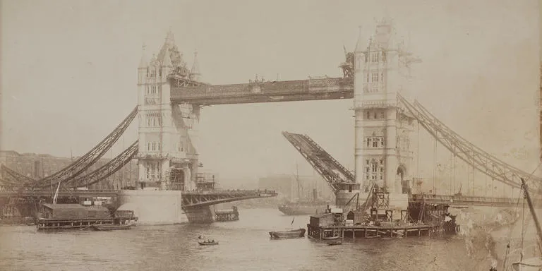
- Tower Bridge
- Guildhall
- County Hall
- Barbican
- Embankment
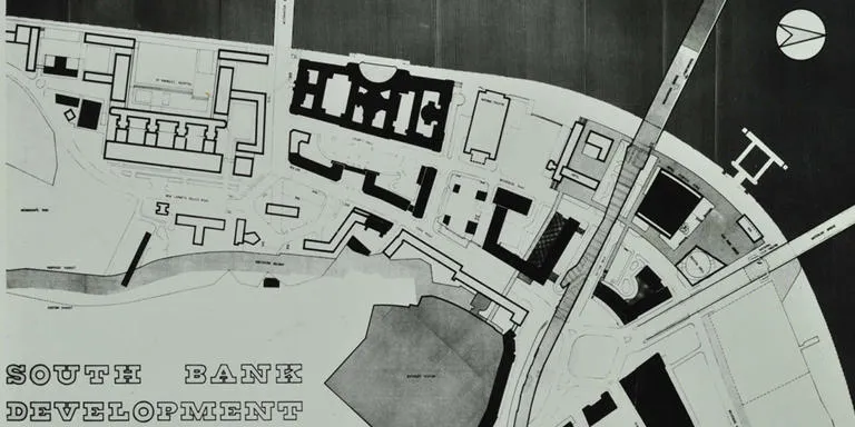
- South Bank complex
The redevelopment of London following the Great Fire in 1666, nineteenth century expansion and change and twentieth century war damage and renewal are very well illustrated. Iconic items include Sir Christopher Wren's architectural drawings for Saint Paul's Cathedral.
Housing schemes are well documented in the Greater London Council and predecessor collections. Provision of accommodation for Londoners includes cottage dwellings of Totterdown Fields to new towns such as Thamesmead and housing programmes outside Greater London. These are complemented by records of London-wide housing trusts such as Guinness Trust, Peabody Trust, and records of Hampstead Garden Suburb.
Strategic town planning records from the Architects and Planning departments include maps zoning areas according to land use and a vast array of reports, policy and case files follow key plans such as the County of London Plan 1943.
Further rich sources include statutory planning files of English Heritage and the Greater London Council which document the listing of and preservation of listed historic buildings during the 20th century. Examples of archives representing the building trade include:
- Higgs and Hill
- John Mowlem
- Empire Stone Works
- J W Falkner and Sons Limited
along with architects, property developers and house builders.
Diocesan records include extensive faculty papers which document church buildings.
Large-scale engineering projects are documented in the Greater London Council Committee and engineering department records. They include the construction of the Thames Barrier and associated bank-raising projects built in prevention of flooding.
Further important engineering include records of the Metropolitan Board of Works and Joseph Bazalgette, chief engineer's involvement in the construction of central London 19th century sewerage system. Utility company records such as predecessors of Thames Water document construction of major reservoir and water supply networks, from New River of the 16th century.